


Space › Universe › Solar System › Star › Sun › Planet › Earth › Moon › Moon › Spacecraft › Lunar Reconnaissance Orbiter
Lunar Reconnaissance Orbiter
ORBITS:
Moon
SPACECRAFT
Mapping the details of our nearest world.
Discover the lunar orbiter whose maps support science and future exploration of the Moon, then explore its mission on the SPACE-di interactive map.
naif:
-85
Reference material: NASA · NASA / Jet Propulsion Laboratory · 3D render credits
Make Lunar Reconnaissance Orbiter part of your exploration…
Lunar Reconnaissance Orbiter: a mission of discovery…
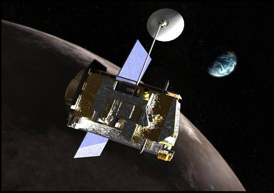
Lunar Reconnaissance Orbiter is a man-made spacecraft represented in the Solar System, the region of space around the Sun, our star, within the universe. Its catalogue reference body is Moon. Explore its story and purpose, then find the spacecraft on the interactive 3D space map.
Lunar Reconnaissance Orbiter — Maps the Moon and gathers information for lunar science and exploration.
Mission and scientific objectives
Lunar Reconnaissance Orbiter is associated with NASA. Maps the Moon and gathers information for lunar science and exploration. The mission type is Lunar orbiter.
NASA's LRO (Lunar Reconnaissance Orbiter) is paving the way for human and robotic exploration of the Moon.
LRO has been studying the Moon from up close since 2009, making it the longest-lived lunar orbiting mission ever. The orbiter has mapped the Moon’s surface and measured its temperature, composition, and radiation environment in unprecedented detail. Data from LRO enables NASA, and our international and commercial partners, to select locations on the lunar surface where spacecraft and astronauts can safely land. The orbiter is also helping NASA identify areas near the Moon’s South Pole with crucial resources like water and extended sunlight, which provides power for equipment and supports exploration activities.
Light and Shadow Near the Moon's South Pole
The pattern of low-angle sunlight and shadows near the Moon's poles is unlike anywhere else on the lunar surface — or on Earth. This visualization, created using LRO data, shows the movement of shadows near the Lunar South Pole over the course of two lunar days (approximately two Earth months).
Mapping the Moon in Three Dimensions
One of LRO's seven science instruments, LOLA (the Lunar Orbiter Laser Altimeter), measures the Moon's elevation profile. This color-coded image is based on LOLA data gathered near the Moon's South Pole. Red coloring indicates high-altitude parts of the landscape, and blue indicates lower-altitude areas. Credit: NASA's Scientific Visualization Studio
NASA, IBM Launch AI Foundation Model for Lunar Science
NASA’s LRO Images Falcon 9 Crater on Moon, Learns New Details
NASA Will Attempt to Observe Rocket Part’s Lunar Impact
NASA Transfers Management of Lunar Science Instruments
The Moon makes Earth more livable, sets the rhythm of ocean tides, and keeps a record of our solar system's…
What’s big, covered in water, yet 100 times drier than the Sahara Desert? It’s not a riddle, it’s the Moon!
Does the Moon have an atmosphere? Yes, but just barely. The lunar atmosphere is mostly an exosphere, which itself is…